Tornado Reports
Sort by Time Sort by Rating Sort by State Sort by County| Time | Rating | Radar | State | County | Location | Narrative |
|---|---|---|---|---|---|---|
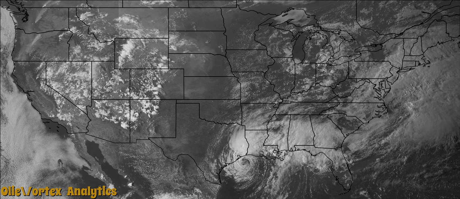
| 22:09Z | EF2 | KLCH | LA | Acadia | Evangeline | A tornado touched down along Riverside Road south of Interstate 10 and south of Bamboo Road where hardwood trees were uprooted. The path continued northeast and crossed the interstate and Evangeline Highway. Along Evangeline Highway a small trailer was flipped. The tornado then crossed Riverside Road again damaging 4 homes, a pick-up truck, motorcycle, fencing, and downing 3 power poles. Of the homes damaged, two had roof damage, a trailer was moved off the blocks, and one was destroyed. The home that was destroyed had the majority of the roof removed and exterior wall failure. The path ended in the field behind the destroyed home. This tornado was also filmed and pictured by several individuals. |
| 22:27Z | EF0 | KLCH | LA | Lafayette | Ridge | Pictures were sent in of a tornado that briefly touched down in a field near Ridge. |
| 22:42Z | EF0 | KLCH | LA | Vermilion | Haire | A tornado briefly touched down in a field. No damage occurred. |
| 06:46Z | EF0 | KMOB | MS | Harrison | (bix)keesler Afb Bil | A tornado touched down one block north of US Highway 90 on Fr. Ryan Street. The storm proceeded northward through Keesler Circle with minor tree damage. The last home in the back of the circle had a large hardwood tree uprooted, which damaged two homes and a vehicle, and moved to the southern edge of Keesler AFB and lifted. A small tree was blown down on the AFB. Estimated maximum wind speed 80 mph. |
| 07:20Z | EF0 | KMOB | MS | Jackson | Pascagoula | An apparent waterspout came onshore near Market Street, producing light to moderate damage for several blocks inland before dissipating. Damage included several downed trees and downed fencing. Two homes were damaged by falling trees. Maximum estimated wind speed 85 mph, damage path 0.25 miles and path width 200 yards. |
Storm reports are derived from "The Storm Events Database" (National Centers for Environmental Information) and/or "Past Storm Reports" (Storm Prediction Center).