Tornado Reports
Sort by Time Sort by Rating Sort by State Sort by County| Time | Rating | Radar | State | County | Location | Narrative |
|---|---|---|---|---|---|---|
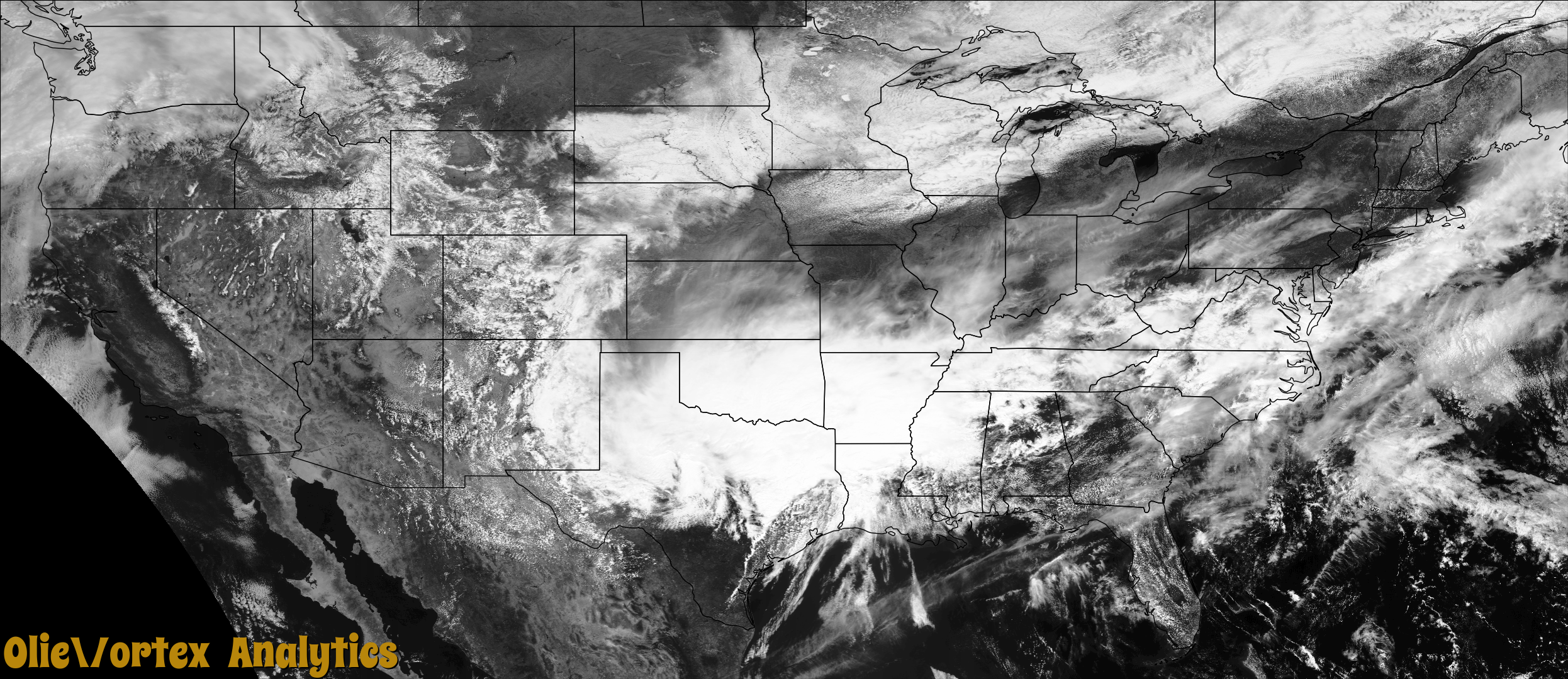
| 15:50Z | EF1 | KGRK | TX | Milam | Branchville | The survey team determined that this tornado first formed just west of the Brazos River in extreme eastern Milam County, approximately 6 miles northwest of Hearne, Texas. The tornado traveled east-northeastward, crossing the Brazos River and moving into Robertson County shortly after developing. |
| 15:52Z | EF3 | KGRK | TX | Robertson | Hearne Muni Arpt | This tornado is a continuation of the tornado that began in Milam County. After crossing the Brazos River, the tornado moved east-northeastward, crossing US Highway 6 approximately 4.5 miles north of Hearne. EF-1 damage was identified at one structure near this highway crossing, and considerable tree damage consistent with EF-1 intensity tornadic winds were observed along the highway right of way. The tornado then proceeded east-northeastward towards Franklin. ||The most significant damage occurred in the city of Franklin. Within a two-block long corridor on the south side of Franklin, the team confirmed EF-3 intensity tornado damage at 2 residences. Peak wind speeds at these sites were estimated at 140 mph. A number of additional structures on the south side of Franklin exhibited EF-1 and EF-2 intensity damage. ||The tornado continued from Franklin east-northeastward along US 79, crossing the Navasota River into far western Leon County. |
| 16:26Z | EF1 | KSHV | TX | Houston | Kennard | The survey discovered tornado damage with trees either uprooted or snapped along a path parallel to County Road 1170. A double wide trailer was destroyed and pushed back into a wooded area at the end of the tornado path. The four occupants of the trailer were injured. Damage scar apparent on satellite data. Aerial photographs also help define path. |
| 16:42Z | EF0 | KGRK | TX | Leon | Venetia | This tornado is a continuation from Milam and Robertson counties. After entering from eastern Robertson County, the tornado dissipated in extreme western Leon County, 4 miles south-southwest of Marquez. Only tree damage was observed along the path in Leon County. |
| 16:46Z | EF2 | KSHV | TX | Cherokee | Morrill | An EF-2 tornado with maximum estimated winds near 120 mph touched down in a rural field approximately 2 miles north of the Neches River. It initially snapped several hundred hardwood and softwood trees at their trunks before destroying two single wide mobile homes and ripping the roof off of a single family home at the end of FM 220 near County Road 2806. There, winds were estimated to be at their strongest at approximately 120 mph. The tornado also tossed several antique vehicles near the home and then went on to snap another 20 trees before lifting along FM 220. |
| 16:52Z | EF2 | KSHV | TX | Cherokee | Alto | The same storm that produced an EF-2 tornado over Southern Cherokee County about 6 miles south southwest of Alto produced another EF-2 tornado with maximum estimated winds near 120 mph across the southern and western sections of the city of Alto, where it damaged structures along Highway 21, Blaton Street, and Putnam Avenue. Damage included shifting a single family home off of its foundation and significant roof damage to another home on Quincy Avenue. Several other homes sustained structural damage as the tornado tracked across the west side of Alto and then crossed Highway 69. The tornado then moved across the Alto Independent School District (ISD) and damaged its gymnasium and roofs to structures on the campus. It was near the Alto ISD where a second stronger tornado crossed paths with this tornado as it tore through the western and northern sections of Alto just over an hour later. |
| 17:12Z | EF1 | KGRK | TX | Leon | North Salem | The supercell thunderstorm that spawned the significant EF-3 tornado in Robertson County tracked into Leon County and produced a second tornado with EF-1 intensity damage. This tornado formed in a heavily forested area 3 miles southeast of Jewett. Several residences and outbuildings were impacted by the tornado in the central part of the county, east of Jewett to the south of Buffalo. Two residences along Leon County Road 363 lost small portions of roof material, with winds estimated around 100 mph. The tornado crossed I-45 about 5 miles south of Buffalo, snapping trees along the Interstate right-of-way. The tornado dissipated approximately 4 miles east of Buffalo. |
| 17:14Z | EFU | KGRK | TX | Robertson | Mumford | A brief EF-0 tornado was confirmed from 3 videos just east of the town of Mumford, TX in southern Robertson County. No damage was reported as the track stayed in open farmland. |
| 17:20Z | EF2 | KHGX | TX | Houston | Post Oak | The EF-2 tornado produced intermittent damage along its track including taking a metal roof off of a home. The most severe damage occurred on the northeast end of the track where trees were stripped of limbs, vehicles were tossed and stacked upon one another and a double wide trailer home was destroyed. |
| 18:00Z | EF3 | KSHV | TX | Houston | Center | The EF-3 tornado damage mainly consisted of snapped pine trees indicative of high end EF-1 damage but much more severe EF-3 damage was discovered northeast of Weches. The most severe damage occurred to a double wide trailer that was destroyed and thrown over 150 years from its original foundation. The one female occupant of the trailer was killed. The path width was as wide as a half mile in places. The tornado continued into Cherokee County and was on the ground for more than 40 miles. |
| 18:20Z | EF3 | KSHV | TX | Cherokee | Morrill | An EF-3 tornado with maximum estimated winds near 160 mph that originally touched down in Houston County about 9 miles northeast of Crockett crossed the Neches River into Southwest Cherokee County, where it snapped and uprooted thousands of trees along its path. The tornado paralleled Highway 21 before reaching the city of Alto, where it severely damaged or destroyed approximately 20 homes. Included along the damage path southwest of Alto was the Caddo Mounds Sate Historic Site building, which had its roof torn off, nearly all of its exterior walls removed, and was left to only a few interior rooms in the building. Several people were outside running to get inside for safety when the building was destroyed, resulting in one fatality and a number of serious injuries. Multiple cars in the parking lot were thrown 150 yards into trees and across Highway 21. The tornado then went on to lift and destroy a double wide mobile home, throwing it 50 yards. As the tornado continued along Highway 21, its most significant damage was at a single family home and the St. Thomas Chapel which saw their roofs and exterior walls collapsed. Winds were estimated at 150 mph at this point. ||As the tornado neared Alto, it destroyed three homes along Highway 294 and Singletary Street, recording high end EF-3 damage as it wiped the lower level of a two story home off of its foundation and left the top story of the home 20 yards away from the foundation. This damage was reviewed by tornado damage experts from the National Weather Service (NWS) Southern Region Headquarters, NWS Norman, and the Warning Decision Training Division who all agreed it was high end EF-3 damage (with maximum estimated winds near 160 mph) based off how the home walls were separated from the bolts which anchored them to the foundation. Surrounding damage indicators also validated the EF-3 tornado determination. ||The storm then went on to destroy several homes and mobile homes at nearby Alto Elementary School and Alto High School. It also snapped a metal power pole before crossing Highway 69, where it went on to snap and debark several trees in rural Cherokee County north of Alto before crossing FM 343 and into extreme Northwest Nacogdoches County. |
| 18:45Z | EF0 | KSHV | TX | Houston | Ratcliff | Damage path discovered at this location. May be longer. Awaiting more info from Forest Service. |
| 18:47Z | EF3 | KSHV | TX | Nacogdoches | Sacul | This is a continuation of the Cherokee County EF-3 tornado that tore through the Alto community. This tornado continued to track northeast across extreme Northwest Nacogdoches County, where numerous trees were snapped and uprooted along County Road 898 and FM 1648 as it approached the Sacul community. The tornado moved through the southeast sections of Sacul, where additional trees were snapped and uprooted, headstones were shifted off their foundations in a cemetery, a metal flag pole was bent at a 45 degree angle, and a tree fell on a home on Highway 204. The tornado continued northeast crossing County Road 988 and just east of County Road 991 near the Rusk County line, where numerous trees were snapped and uprooted, and a large section of a metal roof was torn off of a home, before crossing over into Southern Rusk County. The damage to the home here was the strongest in Northwest Nacogdoches County, with maximum estimated winds near 120 mph. |
| 18:54Z | EF3 | KSHV | TX | Rusk | Reklaw | This is a continuation of the Cherokee and Northwest Nacogdoches County tornado that tore through the Alto and Sacul communities. This tornado crossed County Roads 4265 and 4238 in extreme Southern Rusk County, where numerous trees were snapped and uprooted. The tornado continued northeast across the East Fork Angelina River, Highway 84, and County Road 4233, where it began to weaken as much of the damage over these areas consisted of snapped large limbs. The tornado finally lifted on County Road 4233 near the intersection of FM 2753. The maximum estimated winds in Southern Rusk County was near 105 mph primarily in the area of County Roads 4265 and 4238. |
| 19:38Z | EF1 | KSHV | TX | Nacogdoches | Chireno | An EF-1 tornado with maximum estimated winds near 95 mph touched down along County Road 442 a few miles southwest of Chireno, where numerous trees were snapped or uprooted in a heavily wooded area, while continuing northeast along and across County Road 443. The tornado lifted just east of County Road 443, although the rear flank downdraft from this storm tore off a 100 foot section of tin roofing from a vacant chicken house just off of County Road 442. Portions of the roofs from three other adjacent vacant chicken houses were partially lifted up about two inches. Damaging straight line winds of 80-85 mph from this same storm uprooted a tree in front of the Chireno ISD Building on Main Street in Chireno, with numerous trees downed in a north northeasterly direction along Highway 27 about 1-2 miles east of Chireno near the San Augustine County line. |
| 21:04Z | EF1 | KDGX | LA | Tensas | New Light | This tornado started in a crop field, damaging crops, uprooting and snapping trees in its path. It also rolled one mobile home and destroyed another and lofted an empty fertilizer tank and farm equipment tires a considerable distance. The tornado continued northeast through the field, strewing debris and snapping trees well off in the distance. The tornado then struck an older home along Highway 128, lifting the roof and strewing tin and debris around and in trees. As it crossed the highway, the tornado became fairly wide and strengthened, uprooting and snapping extensive number of trees, with many snapped nearly halfway down. It then continued northeast before crossing Highway 4, Becks Bayou Road and Shackleford Road. In this area many numerous trees were uprooted and large limbs snapped. The tornado then crossed Bell Road, Highway 575, Highway 888 before crossing Highway 898 and Highway 65. All along this path, numerous trees were uprooted, large limbs snapped and some minor roof damage occurred to some homes in this area. Some outbuildings and mobile homes were damaged, with a few pushed off of their cinder blocks. The tornado crossed the highway, snapping some large limbs, before lifting soon thereafter. Maximum estimated winds were 110 mph. |
| 21:13Z | EF1 | KDGX | LA | Tensas | Franklin | The tornado touched down near Shackleford Road, crossing Highway 575, where some trees were uprooted and large limbs were snapped. It continued northeast across Cutoff Road and near the intersection of Turn Row and Highway 65. A large tree was uprooted and snapped and a couple of power poles were snapped near the base along Highway 65 near the intersection of Highway 888. The tornado then crossed the highway and lifted soon thereafter. Maximum estimated winds were 100 mph. |
| 21:35Z | EF1 | KDGX | LA | Madison | King | This tornado touched down right along or just before the levee and State Route 603, uprooting quite a few trees and snapping some large limbs in the path. Some limbs fell on an outbuilding, but otherwise, no structural damage was observed. This weak tornado lifted soon thereafter crossing Highway 603. Maximum estimated winds were 95 mph. |
| 21:44Z | EF0 | KDGX | LA | Madison | Coleman | This weak tornado touched down near Interstate 20. Livestream video was observed from storm spotters of this weak tornado in a field. No notable structure or tree damage was observed during the storm survey. Maximum estimated winds were 70 mph. |
| 21:57Z | EF2 | KDGX | MS | Warren | Waltersville | The tornado started near Clay Street and Mission 66, where numerous trees were uprooted and snapped. Two homes sustained roof damage near Hildegarde Terrace and McAuley Drive due to uprooted trees. The tornado continued northeast snapping small hardwood tree limbs west of Highway 61 on Sherman Avenue. As it begun to move east-northeast, it began to uproot trees on the backside of the River Region Health Center. The tornado moved east-northeast of US 61, snapping large hardwood and softwood tree limbs and snapping hardwood trunks along Brister Road, Boy Scout Road and Oak Ridge Road. Large hardwood trees became uprooted an fell atop of two homes in a home subdivision along Newitt Vick Drive, causing some roof damage. Along Henry Road, east of Oak Ridge Road, several power poles snapped at its base, with numerous uprooted and snapped hardwood trees towards it base on Tucker Road, thus evident of the tornado being at its strongest. The tornado shifted to the northeast towards northeast Warren County, causing numerous uprooted and the snapping of hardwood and softwood trees limbs. Several of these trees fell atop of power lines. The tornado crossed county lines to across southern Yazoo County , resulting in several snapped large hardwood tree limbs along Oak Grove Church Road. The tornado finally lifted at Holloman Road, but not before snapping several hardwood tree trunks. US 61, snapping large hardwood and softwood tree limbs and snapping hardwood trunks along Brister Road, Boy Scout Road and Oak Ridge Road. Large hardwood trees became uprooted an fell atop of two homes in a home subdivision along Newitt Vick Drive, causing some roof damage. Along Henry Road, east of Oak Ridge Road, several power poles snapped at its base, with numerous uprooted and snapped hardwood trees towards it base on Tucker Road, thus evident of the tornado being at its strongest. The tornado shifted to the northeast towards northeast Warren County, causing numerous uprooted and the snapping of hardwood and softwood trees limbs. Several of these trees fell atop of power lines. The tornado crossed county lines to across southern Yazoo County, resulting in several snapped large hardwood tree limbs along Oak Grove Church Road. The tornado finally lifted at Holloman Road, but not before snapping several hardwood tree trunks. The tornado continued into Yazoo County. Maximum estimated winds were 115 mph. Total path length of 20.37 miles. |
| 22:04Z | EF2 | KDGX | MS | Warren | Stout | This tornado started near the Walmart off of Iowa Boulevard where it knocked down some large limbs and also caused some damage to some plants and materials at Walmart. The tornado proceeded northeast along Pemberton Square Boulevard where it caused significant damage to a strip mall. The roof was torn off of the mall and the front windows and doors were blown outward, the tornado was at its strongest at this point. The tornado also bent a large steel pole that had a sign for Taco Bell on it. The canopy at the Kroger was also damaged along with a sign near this location, and some damage to a roof of another business. The tornado continued northeast crossing Halls Ferry Road where it broke some large limbs off of some trees. The tornado continued across Indiana Avenue where it snapped several large hardwood trees. The tornado ended near Highway 27 where it snapped several more trees along the way. Maximum estimated winds were 120 mph. |
| 22:08Z | EF2 | KDGX | MS | Warren | Magnolia Heliport | The tornado began at the intersection of Bowmar Avenue and Jeanette Street, where it impacted a brick home resulting in taking the roof completely off and thus caving in the front of the house. The tornado continued to track east-northeast towards Halls Ferry Road where several large hardwood trees were snapped. As it progressed northeast along Rosedown Street, a small business building had minor roof damage. Additional large hardwood branches were snapped at Marcus Street. An uprooted tree fell on a home and caused extensive damage to the home at Ken Karyl Avenue. The tornado shifted a bit to the northeast causing several large hardwood trees to become snapped and uprooted within Vicksburg National Military Park. Once it reached the I-20 Frontage Road north of Highway 61 near Clifton Drive, it lifted but not before snapping a few hardwood trees. Maximum estimated winds were 115 mph. |
| 22:39Z | EF0 | KDGX | MS | Yazoo | Phoenix | The tornado started near Clay Street and Mission 66, where numerous trees were uprooted and snapped. Two homes sustained roof damage near Hildegarde Terrace and McAuley Drive due to uprooted trees. The tornado continued northeast snapping small hardwood tree limbs west of Highway 61 on Sherman Avenue. As it begun to move east-northeast, it began to uproot trees on the backside of the River Region Health Center. The tornado moved east-northeast of US 61, snapping large hardwood and softwood tree limbs and snapping hardwood trunks along Brister Road, Boy Scout Road and Oak Ridge Road. Large hardwood trees became uprooted an fell atop of two homes in a home subdivision along Newitt Vick Drive, causing some roof damage. Along Henry Road, east of Oak Ridge Road, several power poles snapped at its base, with numerous uprooted and snapped hardwood trees towards it base on Tucker Road, thus evident of the tornado being at its strongest. The tornado shifted to the northeast towards northeast Warren County, causing numerous uprooted and the snapping of hardwood and softwood trees limbs. Several of these trees fell atop of power lines. The tornado crossed county lines to across southern Yazoo County , resulting in several snapped large hardwood tree limbs along Oak Grove Church Road. The tornado finally lifted at Holloman Road, but not before snapping several hardwood tree trunks. US 61, snapping large hardwood and softwood tree limbs and snapping hardwood trunks along Brister Road, Boy Scout Road and Oak Ridge Road. Large hardwood trees became uprooted an fell atop of two homes in a home subdivision along Newitt Vick Drive, causing some roof damage. Along Henry Road, east of Oak Ridge Road, several power poles snapped at its base, with numerous uprooted and snapped hardwood trees towards it base on Tucker Road, thus evident of the tornado being at its strongest. The tornado shifted to the northeast towards northeast Warren County, causing numerous uprooted and the snapping of hardwood and softwood trees limbs. Several of these trees fell atop of power lines. The tornado crossed county lines to across southern Yazoo County, resulting in several snapped large hardwood tree limbs along Oak Grove Church Road. The tornado finally lifted at Holloman Road, but not before snapping several hardwood tree trunks. Maximum estimated winds of the tornado were 115 mph in Warren County, while winds in Yazoo County reached 74 mph. Total path length of the tornado was 20.37 miles. |
| 23:00Z | EF0 | KDGX | MS | Yazoo | Dover | The tornado began in a wooded area about two miles northwest of Bentonia near the Dover Community. The tornado snapped and uprooted a few trees along a roughly three mile path before dissipating. Maximum estimated winds were 74 mph. |
| 23:42Z | EF0 | KDGX | MS | Attala | Newport | This brief tornado occurred in the Big Black river bottom in both Attala and Holmes counties. Snapped and uprooted trees occurred as the wooded river bottom area was impacted. Drone footage was obtained in this area for evidence. Maximum winds were estimated around 90 mph. |
| 23:43Z | EF1 | KDGX | MS | Holmes | Goodman | This brief tornado occurred in the Big Black river bottom in both Attala and Holmes Counties. Snapped and uprooted trees occurred as the wooded river bottom area was impacted. Drone footage was obtained in this area for evidence. Maximum winds were estimated around 90 mph. |
| 00:06Z | EF1 | KDGX | MS | Attala | Hesterville | This brief tornado began southwest of the intersection of Attala Road 3111 and 3102. Numerous hardwood trees were snapped along with some softwoods uprooted and a power pole was broken. The tornado ended approximately one quarter mile northeast of the intersection, snapping a few more trees along its path before dissipating. Maximum estimated winds were 100 mph. |
| 00:09Z | EF0 | KDGX | LA | Madison | Tendal Arpt | This tornado tracked through rural portions of Madison Parish. A tornado debris signature was noted on radar. This tornado crossed Quebec Road and tracked into the Tensas River National Wildlife Refuge where it lifted. Maximum estimated winds were 75 mph. |
| 00:35Z | EF1 | KDGX | MS | Leake | Thomastown | This tornado started on the Highway 429 bridge at the Yockanookany River. Here a number of trees were snapped and uprooted. The tornado then continued north northeast through the wooded river bottom east of the Natchez Trace Parkway. At a point, the western portion of the tornado touched the Trace. Here numerous trees were uprooted and snapped. You can see from this point, extensive tree damage to the east. Based off the radar and the debris signature, the tornado continued just a bit more to the north-northeast before dissipating. Maximum estimated winds were 95 mph. |
| 01:12Z | EF2 | KLIX | MS | Walthall | Kioto | A tornado began in eastern Pike County along Silver Drive. The tornado continued northeast crossing New River Road where a large number of trees were snapped or uprooted. The tornado weakened crossing State Highway 48 before lifting near Mesa Road. Damage was consistent with a tornado of EF-2 strength, with peak winds estimated at 115 mph. Path length was 4.4 miles and path width of 150 yards. Several smaller individual paths were observed in the track, indicating this was likely a multi-vortex tornado. |
| 02:08Z | EF1 | KGWX | MS | Choctaw | Sherwood | This tornado started just south of Crossroads Church Road and tracked northward into the town of Mathiston. At the start, the tornado snapped and uprooted numerous trees. At one home near the start, a tree destroyed a Dodge truck and damaged a shed. The heaviest and most extensive damage was along Reed Road, where hundreds of trees were snapped and uprooted. The center of the tornado was actually just to the west of Reed Road. Just as the tornado crossed into Webster County, it weakened quite a bit and the damage became more of large limbs down with a sporadic snapped tree. This was as the tornado moved into the town of Mathiston. It quickly dissipated just on the north side of Highway 82. Maximum estimated winds were 98 mph. Total path length was 2.66 miles. |
| 02:12Z | EF0 | KGWX | MS | Webster | Mathiston | This tornado started just south of Crossroads Church Road and tracked northward into the town of Mathiston. At the start, the tornado snapped and uprooted numerous trees. At one home near the start, a tree destroyed a Dodge truck and damaged a shed. The heaviest and most extensive damage was along Reed Road, where hundreds of trees were snapped and uprooted. The center of the tornado was actually just to the west of Reed Road. Just as the tornado crossed into Webster County, it weakened quite a bit and the damage became more of large limbs down with a sporadic snapped tree. This was as the tornado moved into the town of Mathiston. It quickly dissipated just on the north side of Highway 82. Maximum estimated winds through the length of the track were 98 mph in Choctaw County. Maximum wind speeds estimated in Webster County were 77 mph. Total path length was 2.66 miles. |
| 02:26Z | EF0 | KGWX | MS | Webster | Dancy | This brief tornado started between Antioch and Johnson Roads. First noted damage was a few uprooted trees on the edge of a field south of Johnson Road. Then along Johnson Road, trees were damaged at a home with one tree on a large shed. A power pole was leaning here as well. The tornado quickly dissipated at this point. Maximum estimated winds were 80 mph. |
| 02:39Z | EF1 | KDGX | MS | Covington | Smith | This tornado touched down at the intersection of Boyd Duckworth and Lilly Valley Church Roads. Some broken limbs and a few downed trees were noted along with skirting blown from a mobile home. Heading northeast, limb damage increased along with a few more trees down. The covering from a porch and the tin roof of a mobile home was taken off. This debris was thrown into another mobile home and caused the door to fly open which then debris caused a minor injury. Other minor tin damage occurred to a few mobile homes here. Tree damage increased as it cross Decar Page Drive. with EF1 type tree damage continuing as it neared Gilmer Road and crossed Gilmer Road. One home had shingle damage and had the base of the roof lifted some. As the tornado crossed into Smith County, it reached peak intensity and numerous trees were snapped and uprooted. At the end of Smith County Road 21 D, heavy tree damage was noted. One home had the car port removed and residents said the house shifted. Some of the tin roof was damaged as well. As the tornado moved along Old Gilmer Road, a large metal shed had the roof removed. The tornado dissipated shortly after along Old Gilmer Road. This tornado continued into Smith County. Maximum estimated winds were 100 mph. Total path length was 4.11 miles. |
| 02:42Z | EF1 | KDGX | MS | Smith | Taylorsville | This tornado touched down at the intersection of Boyd Duckworth and Lilly Valley Church Roads. Some broken limbs and a few downed trees were noted along with skirting blown from a mobile home. Heading northeast, limb damaging increased along with a few more trees down. The covering from a porch and the tin roof of a mobile home was taken off. This debris was thrown into another mobile home and caused the door to fly open which then debris caused a minor injury. Other minor tin damage occurred to a few mobile homes here. Tree damage increased as it cross Decar Page Drive. with EF1 type tree damage continuing as it neared Gilmer Road and crossed Gilmer Road. One home had shingle damage and had the base of the roof lifted some. As the tornado crossed into Smith County, it reached peak intensity and numerous trees were snapped and uprooted. At the end of Smith County Road 21 D, heavy tree damage was noted. One home had the car port removed and residents said the house shifted. Some of the tin roof was damaged as well. As the tornado moved along Old Gilmer Road, a large metal shed had the roof removed. The tornado dissipated shortly after along Old Gilmer Road. Maximum estimated winds were 100 mph. Total path length was 4.11 miles. |
| 02:55Z | EF2 | KGWX | MS | Winston | Loakfoma | This tornado started just to the south of Highway 25 in far northern Winston county. Initially, numerous trees were snapped along with uprooted ones as well. The first property impacted had a few trees through the house, one on a F-150 truck and a couple more on a camper. Several trees were down on a horse barn which was destroyed. The tornado then crossed Highway 25 and quickly became strong. Almost a dozen power poles were snapped along with significant damage to trees. Many hardwoods were snapped and a large section of pines were nearly totally damaged where up to 85% were basically snapped. One mobile home was completely destroyed in this area off Highway 25. One large home, which was more on the edge of the path sustained minor roof damage. The tornado continued to the NNE through an expansive wooded area as it moved into southern Oktibbeha County. Accounts from property owners suggest the extensive tree damage continued as it cross the county line. A cellular tower was collapsed just south of Craig Springs Rd and this is where the tornado reached its peak intensity of 130 mph max winds. The tornado then crossed Craig Springs Rd. Here several homes were damaged and these were a combination of roof damage to more extensive damage from trees downed on them. Several power poles and lines were down here as well. Damage was also done to the cemetery. The intensity dropped a bit here and then a bit more as it continued NNE. It basically paralleled Highway 25 with snapped and uprooted trees noted mainly just off the highway on the western side. As the tornado crossed Ennis Rd, more high end EF1 damage occurred as the tornado narrowed. A church near this area sustained moderate shingle damage to the roof. From this point, the tornado remained just west of the main highway and dissipated about a mile further. |
| 02:58Z | EF2 | KGWX | MS | Oktibbeha | Bugh | This tornado started just to the south of Highway 25 in far northern Winston county. Initially, numerous trees were snapped along with uprooted ones as well. The first property impacted had a few trees through the house, one on a F-150 truck and a couple more on a camper. Several trees were down on a horse barn which was destroyed. The tornado then crossed Highway 25 and quickly became strong. Almost a dozen power poles were snapped along with significant damage to trees. Many hardwoods were snapped and a large section of pines were nearly totally damaged where up to 85% were basically snapped. One mobile home was completely destroyed in this area off Highway 25. One large home, which was more on the edge of the path sustained minor roof damage. The tornado continued to the NNE through an expansive wooded area as it moved into southern Oktibbeha County. Accounts from property owners suggest the extensive tree damage continued as it cross the county line. A cellular tower was collapsed just south of Craig Springs Rd and this is where the tornado reached its peak intensity of 130 mph max winds. The tornado then crossed Craig Springs Rd. Here several homes were damaged and these were a combination of roof damage to more extensive damage from trees downed on them. Several power poles and lines were down here as well. Damage was also done to the cemetery. The intensity dropped a bit here and then a bit more as it continued NNE. It basically paralleled Highway 25 with snapped and uprooted trees noted mainly just off the highway on the western side. As the tornado crossed Ennis Rd, more high end EF1 damage occurred as the tornado narrowed. A church near this area sustained moderate shingle damage to the roof. From this point, the tornado remained just west of the main highway and dissipated about a mile further. |
| 03:18Z | EF1 | KGWX | MS | Oktibbeha | State College | This tornado started just north of Poor House Road in the Mississippi State University property where agricultural and cattle are located. Trees were snapped and uprooted along with a storage shed damaged with tin thrown across the field. The tornado then crossed the road that borders the eastern side of the MSU property. Here, a few dozen trees were damaged. The tornado then crossed through Hillbrook Subdivision, here the most heavy tree damage was noted with numerous trees down, many of which were snapped off hardwoods. Three homes had minor roof damage with one home having a tree on the roof. Intensity peaked here at EF1 and estimated winds were around 105 mph. The tornado continued north-northeast and damaged more trees. Before it crossed Blackjack Road, more tree damaged was noted south of Blackjack. However, the tornado weakened quite a bit as it crossed the road with only some broken limbs noted and a 1-2 trees damaged. The final damage was noted along Muirfield Road as the tornado dissipated. Most of this was large limbs broken with a few downed trees and 2 homes with minor shingle damage. Maximum estimated winds were 105 mph. |
| 04:06Z | EF2 | KGWX | MS | Monroe | Hamilton | The tornado developed just south of Hamilton, MS and rapidly increased in intensity. Substantial damage to residences and outbuildings occurred along Seely Drive south of Hamilton Road. Numerous trees were uprooted or trunks snapped along the track. A tree fell on a mobile home on Center Hill Road north of Hamilton killing the resident. The tornado continued north-northeast, uprooting trees and causing minor structural damage. The tornado dissipated near West Road. Three injuries were also reported. Peak winds were estimated at 130 mph. |
| 04:19Z | EF2 | KGWX | MS | Kemper | Oak Grove | The tornado developed well west of US 45 along Firetower Road, where it uprooted and snapped hardwood and softwood trees. As the tornado propagated northeast to Chapel Hill Church Road, numerous hardwood and softwood trees trunks were snapped midway and low to near the base, barely missing falling on nearby homes and the Chapel Hill Church. It continued along its northeast trajectory, snapping and uprooting numerous softwood and hardwood trees along Porterville-Townsend Road. As the tornado neared US 45, it intersected Sucarnoochee Road where it snapped additional large softwood tree limbs. Just west of US 45 along Douglas Quarters Road, several large hardwood and softwood trees were uprooted or snapped near their base, falling on top of hunting cabins and mobile homes, which resulted in minor to moderate damage. In addition, as the tornado moved northeast across George McDade Road, it peeled almost the entire tin roof off of an outbuilding storage unit at the Electric Mills Manufacturer Company. This tin was blown several yards across US 45 along Gossett Avenue, and was wrapped around snapped trees. Before the tornado lifted, it crossed US 45 to across Gossett Avenue, and littered the area with large uprooted and snapped hardwood trees near its base. Maximum estimated winds were 115 mph. |
| 04:22Z | EF2 | KGWX | MS | Monroe | Greenwood Spgs | Tornado occurred mostly in forested areas. Several homes received primarily roof damage. Several transmission line towers were destroyed approximately 2 miles north of Highway 278. Peak winds were estimated near 115 mph. |
| 04:36Z | EF1 | KDGX | MS | Clarke | Goodwater | This tornado began along County Road 222 in southwestern Clarke County. Initial damage consisted of snapped tree branches and several snapped or uprooted trees. The tornado continued northeast through a wooded area as it passed over Beaverdam Creek. Damage continued along and just off County Road 210, where buildings located on private property sustained roof damage with pieces of tin lofted towards County Road 210. In addition, two metal high tension power line V-trusses were toppled just north of County Road 210, which is where the highest wind speed of 110 mph was assessed. The tornado tracked further northeast into a large wooded and rural area that was inaccessible. The tornado weakened by the time it reached County Road 250, where only several large limbs were down in addition to a chain link fence. Further weakening occurred with the tornado dissipating just northeast of County Road 250 before reaching County Road 275. Maximum estimated winds were 110 mph. |
| 04:48Z | EF1 | KDGX | MS | Clarke | Hale | This tornado began around county road 273, where several trees were uprooted and blocking the road. One home had minor shingle damage. The tornado continued to the north northeast and crossed county road 270. Tree damage was noted across the fields on both sides. As the tornado crossed county road 280, it weakened and was mostly large limbs down. A few trees were down here with one on an older church building. As a result, the whole building collapsed. The tornado increased in intensity again as it crossed county road 114. Here numerous trees were snapped and uprooted. The tornado dissipated just beyond this location. Maximum estimated winds were 95 mph. |
| 04:55Z | EF2 | KDGX | MS | Clarke | Archusa Spgs | This tornado touched down on the south edge of the Archusa Creek Water Park along Ridgewood Road. Mostly large limbs were downed here, but there was a couple trees downed and a power line. The tornado then crossed a portion of the Quitman Country Club golf course and here several trees were uprooted. Damage increased to EF1 along Woodland Hills Drive with a few dozen snapped and uprooted trees. The tornado weakened as it crossed Highway 18, Conoco Lane and US Highway 45. Each of these locations had numerous large limbs down and a couple trees. The intensity increased to EF1 as it crossed county road 142 with numerous snapped trees. As the tornado traversed and crossed county road 140, it reached peak intensity of EF2. Extensive tree damage occurred as a corridor of both hardwood and softwood trees were 'mowed' down in a distinct zone at the center of the path. Also, 7-9 power poles were broken here. The high-end timber damage continue north of county road 140 as it passed through a small portion of the eastern side of Clarke County State Park. The last noted minor tree damage was along county road 147. Maximum estimated winds were 113 mph. |
| 04:57Z | EF1 | KGWX | AL | Marion | Shottsville | National Weather Service meteorologists surveyed damage in Marion County and determined that it was consistent with an EF1 tornado, with maximum sustained winds near 90 mph. The tornado touched down just southeast of the intersection of County Road 13 and Grant Road. It rapidly intensified as it tracked northward and crossed County Road 13, where it uprooted dozens of pine trees and a few hardwoods. The tin was partially torn off a small barn and was deposited to the west of the path. Just as quickly as the tornado intensified, it dissipated just north of County Road 13 before reaching County Road 56. |
| 05:14Z | EF1 | KGWX | AL | Franklin | Seven Pines | The tornado touched down on County Road 25 off of County Road 247. Several hardwood and softwood trees were snapped and uprooted at a home on the south side of CR 25. The tornado crossed CR 25 and continued to snap and uproot hard and softwood trees as it crossed CR 247. The tornado continued moving northward through a wilderness area between CR 247 and Winchester Road, snapping and uprooting numerous trees along the path. North of the|wilderness area and a ridge, the tornado approached Winchester Road near the intersection of CR 90. On Winchester Road, the tornado damaged a barn, a wooden outbuilding, and snapped and uprooted trees. It was at this point that the tornado was at its widest at 80 yards. From there, the tornado moved northward toward Highway 90. Along the path, the tornado snapped or uprooted numerous hardwood and softwood trees. Along Highway 90, the tornado blew a tree onto a house, and strewed tin from a farm outbuilding several hundred yards to the north-northeast. The tornado skipped further northeast, snapping and uprooting trees as it traveled toward Coon Dog Cemetery. The tornado lifted shortly before the Colbert County line and no damage was noted northeast of the county line. Damage with this tornado was consistent with an EF-1 tornado, which was assessed at having 100 mph winds. |
| 06:26Z | EF0 | KBMX | AL | Hale | Gallion | National Weather Service meteorologists surveyed damage in Hale County and determined that it was consistent with an EF0 tornado, with maximum sustained winds near 80 mph. The tornado touched down on the south side of E Z Street just south of Highway 80 and tracked northeast where it knocked over a trailer at Mount Olive Missionary Baptist Church. The tornado continued northeast across Gallion Road where it caused timber damage and ripped most of the metal roofing and sides off a large metal shed. Timber damage continued as it moved northeast, impacting portions of Davis and Hall Roads. A home just west of Hall Road suffered minor damage to shingles and overhangs while a home on the north end of Hall Road was impacted by an uprooted tree that resulted in partial roof damage. A large shed between Hall Road and Highway 69 lost nearly all of its metal roof. North of the damaged shed, a home suffered minor siding damage. The tornado then tracked northeast, causing timber damage as it crossed Highway 69 and destroying a shed along with damaging another larger shed. Notable timber damage was observed north and northeast of this point as the tornado moved east of Highway 69 into uninhabited and inaccessible areas. Tornado damage was evident from Prairie Oaks Ranch located on Pecan Road. The tornado caused damage to several trees on the property and some fencing along Cat Bottom Road. The tornado moved northeast across open fields with timber damage along a tree line found along County Road 10. The tornado tracked northeast across County Road 9 where it ripped some metal tin off of a barn and caused additional tree damage. The tornado moved across open fields until it impacted portions of a tree line along a farm road just west of Highway 9. Additional timber damage was found further north along County Road 9 as the tornado turned more northeast. The tornado caused sporadic tree damage before lifting just south of County Road 16. |
| 06:35Z | EF1 | KGWX | AL | Colbert | Spring Vly | The tornado touched down on far southern Renee Drive, at the beginning of the Aycock Heights subdivision. It proceeded to move northward through the subdivision, uprooting and snapping numerous hardwood and softwood trees along its path. Minor structural damage was noted in the subdivision in the form of roof and shingle damage, with several unanchored outbuildings or sheds destroyed. The tornado was at most 70 yards wide within the subdivision. The tornado then damaged a billboard as it crossed Highway 72, before snapping and uprooting several hardwood and softwood trees at a home across the highway from Aycock Heights. An RV was flipped on its side at this location, with |other minor roof damage noted on the home. The tornado uprooted a few trees just north of this location before dissipating in the field just northeast of the property. Damage with this tornado was consistent with an EF-1 tornado, which was assessed at having 100 mph winds. |
| 07:20Z | EF1 | KBMX | AL | Tuscaloosa | Hagler | National Weather Service meteorologists surveyed damage in Tuscaloosa County and determined that it was consistent with an EF1 tornado, with maximum sustained winds near 105 mph. Although it was uncertain as to the exact location of initial touchdown due to inaccessible land, a TDS detected by the KBMX WSR-88D indicates the tornado touched down just north of the Bibb-Tuscaloosa county line. The first damage from the tornado was near Highway 82 near the intersection with Hagler-Coaling Road, where a few weakened large trees were snapped. Several trees fell into the highway but were removed before the survey. As the tornado crossed Highway 82, it intensified rapidly, uprooting scores of hardwood trees, removing the roof off a small barn, and peeling all the shingles off of a home. A cow was killed by one of the falling trees. The tornado continued north-northeastward over a hill and then down across Hagler-Coaling Road. The tree damage was not as concentrated, but several large hardwoods were snapped or uprooted, and a home sustained roof damage. The tornado lifted just east of Hagler-Coaling Road. |
| 07:50Z | EF1 | KMOB | MS | Jackson | Coll Town | A NWS storm survey found that a high end EF-1 tornado touched down near the Pascagoula River. Where it touched down, three camps received damage. The most extensive damage was roof damage greater than 30 percent. A back wall was moved 3 inches due to the force of the wind, but remained structurally intact. The tornado moved northeast to Windrow Road, where it caused more roof damage. The storm then moved across Prescott Road where it briefly lifted the roof off of a home, causing roof and siding damage and blown out windows. The tornado then continued northeast, causing tree damage along Foxshire and Sheffield Roads before lifting along Sheffield Road. The path length was 1.1 miles and path width 50 yards. Maximum estimated wind was 110 mph. |
| 08:21Z | EF0 | KBMX | AL | Perry | Sprott | National Weather Service meteorologists surveyed damage in Perry County and determined that it was consistent with an EF0 tornado, with maximum sustained winds near 80 mph. The tornado touched down near Iveys Chapel Church Road where a few trees were snapped. The tornado tracked northeast across inaccessible terrain until it crossed Mount Pilgrim Church Road where it uprooted some trees. The tornado continued northeast where it neared County Road 219 and removed a small portion of a farm shed. The tornado continued across agricultural fields then caused timber damage as it neared areas of trees. The tornado caused damage to homes just south of Melton Lane off of Highway 219. The tornado ripped nearly half of the roof off of a home and damaged siding. On the northwest side of the home strong winds pulled out two of the three support columns for the carport and that resulted in the roof partially collapsing. The tornado moved north along Highway 219 where it continued to cause notable timber damage. The tornado then tracked northeast across County Highway 183, where more timber damage occurred. The tornado continued northeast before dissipating near Barnette Road. |
| 09:05Z | EF0 | KBMX | AL | Shelby | Simmsville | National Weather Service meteorologists surveyed damage in Shelby County and determined that it was consistent with an EF0 tornado, with maximum sustained winds near 80 mph. The tornado touched down just northeast of County Road 11 near County Road 36. This area was inaccessible, and the tornado start point was based upon a NEXRAD tornado debris signature from the KBMX radar. The tornado navigated rough terrain across Ivy Branch and into the northwest portion of a subdivision along Reach Crest Road and Reach Crest Drive, where thin tree trunks were snapped and other trees were uprooted. One tree was uprooted and fell onto a sports utility vehicle, damaging the rear door and knocking out the window. A nearby residence suffered notable roof damage resulting in three holes that penetrated the ceiling sheet rock and causing water damage to portions of the second level.||The tornado continued northeast where limited uplift to a roof occurred and a wind turbine ventilator was torn off the roof and found over 20 feet away from the home. Across the street along a narrow drainage basin, the funneling of inflow winds likely caused wind speed acceleration that knocked over a heavy metal outdoor grill, tore a few downspouts from their wall anchoring, and downed some fencing by snapping the support posts and blowing the wood at least 10 feet. Further northeast a small portion of a covered drive suffered some uplift of sheathing at North Shelby Baptist Church, where a few trees were snapped or uprooted near the entrance of Belcher Drive. To the east of Highway 280, multiple trees were snapped or uprooted along a portion of Old Highway 280 road near Salser Lane. The tornado tracked north-northeast of this point through uninhabited and inaccessible areas and then reached the Highland Lakes Subdivision where it crossed Highland Lakes Drive and affected areas along Southledge Road. The majority of damage here was due to snapped or uprooted trees though some minor roof damage was noted to a home along Southledge Road. Further northeast along Southledge Road near Ledge Circle, a home lost some shingles and a portion of a backyard fence was downed due to the winds.||The tornado continued northeast and affected some areas along Highland Lakes Trail,|Springhill Lane, Springhill Court, Mountain Trace, and Watersedge Circle. Nearly all of the damage in this area was to uprooted or snapped trees. One home did lose a window likely due to a falling tree. Further northeast the tornado produced tree damage on portions of Knollwood Drive, Watermill Circle, Highland Lakes Trail, Sandhurst Circle, Grove Park Parkway, and Grove Park Circle. Along Grove Park Parkway there was some roof damage to a home along with minor damage to two signs and one street light along the roadway. The tornado damage was confined to trees as it continued northeastward affecting portions of Milners Lane, Crescent Circle, Milners Way, Milner Road West, Milner Way, Hugh Daniel Drive, and Greystone Cove Drive. The tornado gradually weakened in this area and dissipated shortly before reaching Lake Hardwood Drive. |
| 09:14Z | EF0 | KBMX | AL | Shelby | Calera | National Weather Service meteorologists surveyed damage in Shelby County and determined that it was consistent with an EF0 tornado, with maximum sustained winds near 70 mph. The tornado touched down near County Road 16 where it crosses the Vulcan Quarry, causing minor timber damage across Shelby County Road 16 that blocked the roadway. The tornado continued to the north-northeast through inaccessible forested areas and crossed the northern extent of the quarry where no damage was reported by personnel. The tornado moved nearly due north and caused some minor timber damage as it crossed Shelby County Road 22 and uprooted trees as it moved across Sharpsburg Circle. A nearby home had a portion of its wooden fence supports broken due to the winds. Behind a house three trees were uprooted. A few trees were uprooted at the eastern end of Ivanhoe Lane. Further to the north, the tornado crossed Rossburg Drive and Rossburg Place, causing significant roof damage to one home, broke apart portions of five fences, deposited plywood and some roofing material on the roof an other homes, uprooted a few trees and tore a small portion of a roof off of an upstairs room. The tornado then continued northward, between Little John Circle and Nottingham Drive, where it dissipated. |
| 11:28Z | EF1 | KHTX | AL | Etowah | Glencoe | National Weather Service meteorologists surveyed damage in Etowah County and determined that it was consistent with an EF1 tornado, with maximum sustained winds near 95 mph. This tornado began near Taylor Road where a large tree was uprooted and light trim damage was done to a house. Damage intensity rapidly increased as the tornado crossed Rabbittown Road. One residence had significant damage done to its roof and an exterior wall, along with broken windows. A car was also picked up/shifted. A second residence, which appeared to have very little/no anchoring, was greatly shifted from its foundation with heavy roof damage and broken windows. Across the street, a third residence had significant roof and wall damage, along with broken windows. The pattern of fallen trees in this vicinity indicated a cyclonic wind pattern, helping to confirm tornadic winds despite the storm`s presentation on radar.||The tornado continued northeastward, knocking down additional trees as it crossed Highway 278. Several outbuildings were destroyed and tossed downwind at a residence located along Tidmore Bend Road. The tornado then crossed the Coosa River and caused light roof damage to a dock as well as knocked down some trees before dissipating just before Alford Bend Road. |
| 11:50Z | EF0 | KEOX | AL | Pike | Henderson | National Weather Service meteorologists surveyed damage in southwest Pike County and determined that it was consistent with an EF0 tornado, with maximum sustained winds near 70 mph.||The tornado initially touched down north of County Road 6, several miles south of Goshen. It tracked north-northeast mainly over rural farmlands and open fields. Due to the lack of road access, the path width and length were estimated. Wind speeds were based on trees uprooted west of County Road 2243. The survey was prompted by a distinct TDS from the Fort Rucker WSR-88D. |
| 11:53Z | EF0 | KEOX | AL | Crenshaw | Social Town | The tornado formed west of Goshen, AL near the intersection of Jones Bridge Rd and Athen Church Rd where it uprooted trees and tore the roof off of a chicken barn. The tornado continued east causing damage to tree limbs before crossing N Goshen Rd into Pike County. |
| 11:57Z | EF0 | KEOX | AL | Pike | Goshen | National Weather Service meteorologists surveyed damage in far western Pike County and determined that it was consistent with an EF0 tornado, with maximum sustained winds near 70 mph. ||The tornado initially touched down just west of Jones Bridge Road in Crenshaw County.|The tornado crossed into Pike County just north of Greenville Avenue and lifted west of the town of Goshen. Damage in Pike County consisted mostly of uprooted trees and a gas station suffered minor damage. |
Storm reports are derived from "The Storm Events Database" (National Centers for Environmental Information) and/or "Past Storm Reports" (Storm Prediction Center).