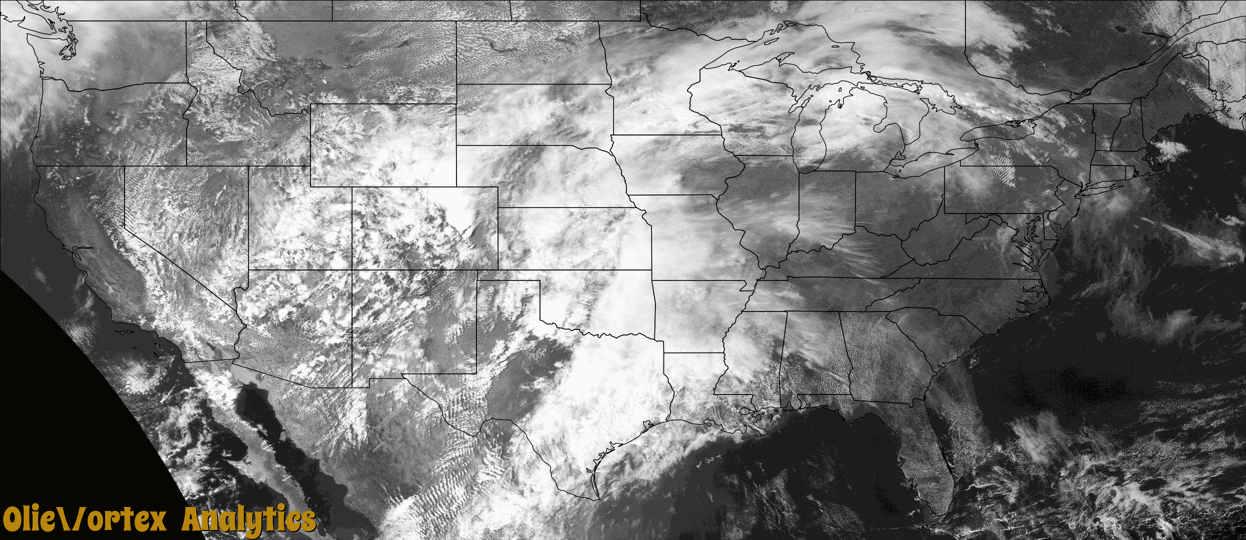
Tornado Reports
Sort by Time Sort by Rating Sort by State Sort by County| Time | Rating | Radar | State | County | Location | Narrative |
|---|---|---|---|---|---|---|
| 20:32Z | EF0 | KPUX | CO | Lincoln | Punkin Center | A tornado touched down briefly in an open field. No damage was observed. |
| 20:49Z | EF3 | KFDR | TX | Knox | Truscott | This tornado formed approximately six miles west of Truscott and initially moved just north of due east with occasional damage to mesquite trees. As it approached County Road 2610 and FM 1756 a semi truck was knocked over, and a 4000 pound cattle feeder was blown about 850 feet to the north-northeast. Two structures on the southeast side of Truscott-Brine Lake received roof and window damage. Utility poles were broken from the area just southeast of Truscott-Brine Lake to State Highway 6, including steel utility poles that were bent. The tornado weakened and then dissipated after crossing Highway 6. |
| 21:57Z | EF0 | KPUX | CO | Lincoln | Karval | A tornado briefly touched down in an open field. No damage was observed. |
| 22:08Z | EFU | KPUX | CO | Cheyenne | Aroya | First of several tornadoes that occurred in quick succession. This was the larger initial one that was captured by storm chaser footage and reported by law enforcement. |
| 22:08Z | EFU | KPUX | CO | Cheyenne | Wild Horse | This second tornado occurred simultaneously with a larger tornado (first tornado entered). This one was visually smaller according to storm chaser footage. |
| 22:15Z | EFU | KPUX | CO | Cheyenne | Sorrento | Chaser footage showed a smaller satellite tornado to the parent circulation. This tornado began, and was immediately followed by a much larger tornado. This is the third tornado produced by this storm in short succession. |
| 22:16Z | EFU | KPUX | CO | Cheyenne | Sorrento | This is the fourth tornado that occurred in rapid succession. This tornado, visually from storm chaser stream, was the largest tornado of the day. It continued across open country of southwestern Cheyenne County Colorado. A satellite tornado began shortly before this one, which was the third tornado of the day. |
| 22:28Z | EFU | KPUX | CO | Cheyenne | Sorrento | Tornadoes viewed on live chase stream. Based on photos/videos submitted, as well as radar imagery, believe this to be the fifth tornado produced by this storm. |
| 22:54Z | EFU | KPUX | CO | Cheyenne | Sorrento | Storm chaser submitted video, on social media, of a tornado crossing US HWY 40 west of Kit Carson. |
| 23:27Z | EFU | KGLD | CO | Cheyenne | Firstview | Landspout tornado, multiple reports received along with video of tornado near the intersection of county roads DD and 32 in northern Cheyenne County. |
| 00:15Z | EF0 | KFDR | OK | Tillman | Hollister | A storm chaser observed a brief tornado estimated to be about 9 miles south of Hollister. No damage was reported. |
| 00:19Z | EFU | KFDR | TX | Wilbarger | Grayback | Three storm chasers reported a tornado that was observed from a long distance. The tornado lasted about a minute, and produced no known damage, so the location is estimated. |
| 00:47Z | EF0 | KSJT | TX | Scurry | Hermleigh | A thunderstorm produced a tornado near Hermleigh, TX with multiple reports from spotters. This tornado was rated as an EF-0 and the path length and width as well as total duration were estimated. No damage was reported. |
| 05:00Z | EF1 | KTLX | OK | Garvin | Pauls Valley | A tornado developed about 4 miles southeast of Pauls Valley and moved northeast and then north dissipating about 4 and a half miles east-northeast of Pauls Valley. One home on county road 3285 suffered roof damage. At least one outbuilding was destroyed and two others damaged along the path. |
| 11:01Z | EFU | KSRX | OK | Adair | Bidding Spgs | This tornado produced a tornadic debris signature on the KSRX WSR-88D that lasted at least three minutes. The survey team could not access the heavily wooded area where this tornado likely occurred due to the lack of roads transecting the path. |
| 11:06Z | EF1 | KSRX | OK | Adair | Stilwell | This tornado damaged a home, destroyed a couple outbuildings, damaged chicken houses, and uprooted trees. Based on this damage, maximum estimated wind in the tornado was 90 to 100 mph. |
Storm reports are derived from "The Storm Events Database" (National Centers for Environmental Information) and/or "Past Storm Reports" (Storm Prediction Center).