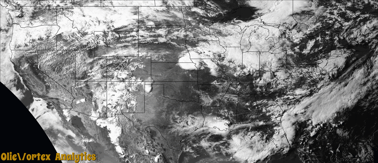
Tornado Reports
Sort by Time Sort by Rating Sort by State Sort by County| Time | Rating | Radar | State | County | Location | Narrative |
|---|---|---|---|---|---|---|
| 19:00Z | EFU | KPDT | OR | Umatilla | Barnhart | The Pendleton Airport air traffic controller relayed a report from a pilot travelling south of the airfield that debris and dust was being picked up by a small tornado. A funnel cloud was observed by NWS personnel and by the public shortly before the relayed report. |
| 22:18Z | EFU | KTWX | NE | Gage | Blue Spgs | Trained spotter reported a brief touch down of a tornado east of Blue Springs. |
| 22:40Z | EF1 | KTWX | NE | Gage | Krider | The tornado started approximately 7 miles south-southwest of Wymore, NE, doing damage to trees just west of S 23 Rd between E Walnut Rd and Willow Rd. The tornado continued south-southeastward, damaging the roof of a residence and barn, as well as power poles along Willow Rd. The track then turned more southeast, crossing State Line Rd into Marshall County, KS, between 8th Rd and S 36 Rd where damage to farm outbuildings was noted. The tornado continued southeast and caused damage to power poles along US Highway 77 just south of Bison Rd before lifting shortly thereafter. |
| 22:43Z | EF1 | KTWX | KS | Marshall | Oketo | Damage survey revealed a garage was destroyed on the south side of state line road with debris thrown north back into Nebraska (across the road). A sporadic damage path moved southeast and ended around highway 77 where power poles were broken along with some tree limb damage. This tornado moved south out of Nebraska and ended in Kansas. |
| 22:53Z | EF1 | KTWX | KS | Marshall | Hull | A sporadic damage path extended south southwest into the city of Marysville. The damage from any small tornado is nearly indistinguishable from the widespread 80-100 mph straight line wind damage from the rear flank downdraft hybrid wet downburst that preceded it. A few buildings on the west side of Marysville were damaged by the enhanced winds associated with the small tornado. The remainder of the damage was tree branches snapped and uprooted trees. |
| 23:02Z | EF1 | KTWX | KS | Marshall | Marysville Arpt | Storm survey and storm chaser video and photos revealed a brief tornado just northeast of Marysville. This tornado did damage to a barn and power pole short path. The damage to a lumber shop south of highway 36 appears to have been related to a possible RFD surge south (straight line winds) and not this tornado. |
| 23:26Z | EF1 | KTWX | KS | Marshall | Bestwall | Another tornado path that was nearly indistinguishable from the widespread straight line wind damage that preceded it into the north side of Blue Rapids. It appears that a tornado did damage along a path that traveled just north of a Georgia Pacific Plant along and just west of highway 77 where it derailed train cars then pushed south into the river bottoms snapping trees. The track became very broad as it approached the river where it appears it transitioned to a damaging downburst surge of 100-105 mph straight line winds across the city of Blue Rapids with the worst damage on the west side of the city. |
| 00:04Z | EF1 | KTWX | KS | Pottawatomie | Fostoria | A tornado formed just east of Olsburg and tracked south southwest to the Spillway State Park on the southeast side Tuttle Creek Reservoir. The circulation became broad and dominated by the northwest winds of the RFD (rear flank downdraft) as it moved over the Tuttle Creek Dam and state park. Enhanced destructive northwest winds then appeared to have descended into the city of Manhattan where widespread 80 to 100 mph winds were likely and did widespread damage. Radar also indicated smaller microbursts where winds were likely in excess of 100 mph out of the NNW across the city of Manhattan. NWS survey documented the worst damage in Manhattan where winds were likely 100 to 110 mph. |
| 00:20Z | EF2 | KTWX | KS | Riley | Manhattan | Two surveys were done by NWS for this damage. It appears that a very short path narrow tornado occurred embedded on the northeast flank of small enhanced downburst that created widespread damaging north to northwest winds. Several homes were heavily damaged with the debris field blown to the northeast or approximately perpendicular to the movement. It appears the tornado was narrow and only 25-50 yards at the widest. |
| 00:32Z | EFU | KTWX | KS | Riley | Zeandale | A storm chaser showed video of what appeared to be a brief funnel near the ground in open country north of Interstate 70. Any actual contact with the ground was brief and no damage was noted or reported. The feature lost its organization as it moved south over I-70. |
| 03:07Z | EF0 | KEAX | MO | Clinton | Hemple | A brief tornado occurred and did some damage to a pole barn near Hemple, Missouri. |
Storm reports are derived from "The Storm Events Database" (National Centers for Environmental Information) and/or "Past Storm Reports" (Storm Prediction Center).