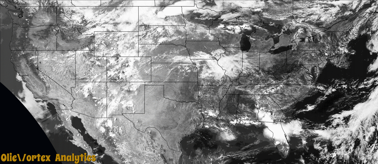
Tornado Reports
Sort by Time Sort by Rating Sort by State Sort by County| Time | Rating | Radar | State | County | Location | Narrative |
|---|---|---|---|---|---|---|
| 19:56Z | EF0 | KMVX | ND | Cavalier | Milton | Tornado was filmed by at least 2 individuals, one just south of Milton and one west of Milton on highway 66. It slowly tracked for about one half mile to the northeast, to around 2.5 wsw of Milton by 258 pm cdt. The tornado produced a fairly wide dust plume as it moved across and open field. Peak winds estimated to 75 mph. Maximum width to 10 yards. Videos and reports posted via social media. |
| 20:27Z | EF1 | KMVX | ND | Walsh | Adams | A condensation funnel and ground swirl were briefly visible before rain obscured view. Resultant ground track was evident as numerous snapped boxelder and ash trees through several field shelter belts from northeast Vesta Township into southeast Tiber Township. Tornado likely tracked to the NNE for nearly 2 miles to near 3.5 WSW Edinburg by 333 pm CDT. Peak wind estimated to 90 mph. Maximum width to 100 yards. |
| 20:42Z | EFU | KBIS | ND | Wells | Chaseley | The tornado touched down in an open field north of Chaseley and impacted no structures. There was no damage to evaluate. By National Weather Service policy the tornado is rated EF Unknown. |
| 21:52Z | EF0 | KMVX | ND | Nelson | Tolna | A persistent wall cloud with brief funnel and tornado was noted and filmed by chasers located in Tolna. The tornado likely lasted for a minute or less as it tracked eastward, well behind the initial storm outflow, for a half mile or less. Peak winds estimated to 75 mph, with a maximum width to 100 yards. |
| 22:01Z | EF0 | KMVX | ND | Nelson | Tolna | Persistent wall cloud, with brief funnel and large and dusty ground swirl reported over an open field. Tornado lasted less than a minute and was viewed from near Pekin. Peak winds estimated to 75 mph. Maximum width to 100 yards. |
| 22:15Z | EF0 | KMVX | ND | Nelson | Mc Ville Arpt | A brief touchdown was noted in central Hamline Township by spotters located approximately 1 nw of McVille. Touchdown lasted less than a minute. Peak winds were estimated to 75 mph, with a maximum width to 100 yards. |
| 22:34Z | EF0 | KMVX | ND | Grand Forks | Larimore | Storm spotters reported a tornado occurring south of highway 2 and west of hwy 18. Tornado appeared to track eastward to near hwy 18, north of larimore by 540 pm cdt. Some tree branch damage was noted but nothing damaged structurally. Peak winds estimated to 80 mph, with a maximum width to 100 yards. |
| 01:40Z | EFU | KGLD | NE | Dundy | Benkelman Jones Arpt | Brief landspout tornado observed by a couple trained spotters. Based on their accounts as well as radar imagery, this tornado occurred west of HWY 61 a few miles north of Benkelman, NE. Tornado stayed in open fields and no damage was observed. |
| 02:16Z | EF0 | KMVX | MN | Pennington | Erie | A brief touchdown was noted in an open field just north of MN Hwy 1. A dust swirl was evident but no damage was apparent. A nearby MNDOT RWIS station registered a peak wind of 71 mph. Maximum width estimated to 40 yards. |
| 02:16Z | EF1 | KMVX | MN | Mahnomen | Naytahwaush | This tornado was likely wrapped in downburst winds and heavy rain as is tracked east northeastward across North Twin Lake and the community of Naytahwaush, ending around 1 ene of town by 923 pm CDT. The tornado snapped or uprooted numerous pine, poplar, and oak trees. It tore roughly 40 percent of the roof decking off of one house and shingles and roofing materials off of other buildings along its path. Peak winds were estimated to 105 mph, with a maximum width of 400 yards. |
| 02:58Z | EF2 | KMVX | MN | Becker | Rochert | This tornado was likely wrapped in downburst winds for portions of its nearly 31 mile path through Little Toad Lake, Toad Lake, and Wolf Lake, ending around 2 se of Menagha by 1035 pm cdt. Numerous pine, oak, and poplar trees were violently snapped or uprooted along with several wooden power poles. Farm outbuilding roofs were ripped off. A modern hog barn, an older style barn, and several smaller outbuildings were blown down at various farmsteads. Max winds to 115 mph, with a max width of 600 yards. |
Storm reports are derived from "The Storm Events Database" (National Centers for Environmental Information) and/or "Past Storm Reports" (Storm Prediction Center).