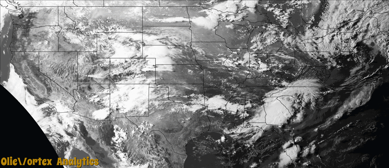
Tornado Reports
Sort by Time Sort by Rating Sort by State Sort by County| Time | Rating | Radar | State | County | Location | Narrative |
|---|---|---|---|---|---|---|
| 15:20Z | EF1 | KBOX | MA | Plymouth | Shell Beach | A small EF-1 tornado touched down in the town of Mattapoisett Massachusetts|at 11:20 AM EDT. The storm was on the ground for approximately 3 minutes.|The storm moved to the northeast at approximately 20 MPH and lifted off the|ground on North Street just north of Eldorado Drive. Numerous large Pine and |Maple trees were uprooted falling in serveral directions. There were also |numerous pine trees along the path that were snapped off between 10 and 20|feet above the ground. The most concentrated damage was found along Eldorado|Drive by Granada Court. The top wind speed was estimated to be 95 mph. |
| 15:52Z | EF0 | KBOX | MA | Barnstable | Marstons Mills Arpt | A small EF-0 tornado touched down in the town of Barnstable, near|the village of Marstons Mills, at 11:52 AM. The storm tracked ENE|from Evergreen Drive for approximately four minutes before |lifting over Joe Thompson Road, at approximately 11:56 AM. The |primary damage indicators were an uprooted hardwood tree and a|downed electrical pole, supplemented by strewn debris inclusive |of smaller trees, fence posts, and branches. The damage was most |concentrated near the center of the track at the intersection of |Race Lane and Osterville-West Barnstable Road. Witnesses described|a chaotic event, observing airborne fence posts and branches. Top wind speeds were estimated at 80 mph. |
| 19:50Z | EF0 | KFSX | AZ | Coconino | Moenave | Landspout tornado was spotted 10 miles north of Cameron, Arizona at 1:50 MDT. Only visible lofted debris was dust. Dissipated within 10 minutes after sighting. Video on Twitter. |
| 22:39Z | EF1 | KGLD | CO | Washington | Otis | A tornado touched down in an open field just southeast of Otis and continued to move east-southeast throughout eastern Washington County. As it approached County Road ZZ it lifted a garage off its foundation anchoring, and shifted it. The garage door also imploded and about 10% of roof structure was lost. Other damage included snapped trees and broken wood power poles, with lesser damage to outbuildings. The tornado continued to track east-southeast into Yuma County. |
| 22:50Z | EFU | KCYS | NE | Morrill | Broadwater | Received video from Facebook of a brief tornado north of Broadwater causing no damage. |
| 22:57Z | EF3 | KGLD | CO | Yuma | Yuma Arpt | The tornado began in far eastern Washington County near the town of Hyde and moved east-southeast into northwest Yuma County. In Yuma County, the tornado remained southwest of the city of Yuma, where it looped around three times along the path causing damage to irrigation pivots, trees, and numerous power poles. The tornado dissipated during a fourth large loop. There was also significant damage to a residential property, three grain bins, and a machine shed towards the end of the path. Image of the actual tornado path is attached. |
| 23:30Z | EFU | KGLD | CO | Yuma | Schramm | A multivortex tornado was observed moving between County Roads 34 and 29 across open land. No damage was reported. |
| 00:04Z | EF0 | KGLD | CO | Yuma | Abarr | Chasers observed a tornado in the location with damage to corn crop circles found via Sentinel 2 imagery. |
| 00:19Z | EFU | KGLD | CO | Yuma | Abarr | Multiple storm chasers reported a brief rope tornado over an open field. No damage was observed. |
| 00:23Z | EFU | KGLD | CO | Yuma | Abarr | A tornado remained in open fields, short of crossing County Road J. No damage was observed. |
| 01:00Z | EFU | KGLD | CO | Yuma | Kirk | The tornado faded and reappeared more than once during its lifetime. The tornado ended before crossing CR S, remaining over an open field. No damage was observed. |
| 01:25Z | EF2 | KGLD | CO | Yuma | Idalia | Based on damage to power poles the tornado tracked south than east along CR 2. The tornado damaged half an irrigation pivot and snapped nine power poles along CR 2. Then it shifted south again before reaching the CR2/ CR Y intersection. Based on radar data the tornado continued south-southeast into Kit Carson County, ending northwest of the CR MM/CR 44 intersection. |
| 01:40Z | EF2 | KGLD | CO | Kit Carson | Burlington Arpt | Based on damage to power poles the tornado tracked south then east along CR 2. The tornado damaged half an irrigation pivot and snapped nine power poles along CR 2. Then it shifted south again before reaching the CR2/ CR Y intersection. Based on radar data the tornado continued south-southeast into Kit Carson County, ending northwest of the CR MM/CR 44 intersection. No damage was observed in Kit Carson County. |
| 03:17Z | EFU | KGLD | KS | Sherman | Kanorado | A long-track supercell produced a EF-U tornado southeast of Kanorado. Only damage observed was some swirl marks in the plants and grass found at an abandoned property. |
Storm reports are derived from "The Storm Events Database" (National Centers for Environmental Information) and/or "Past Storm Reports" (Storm Prediction Center).