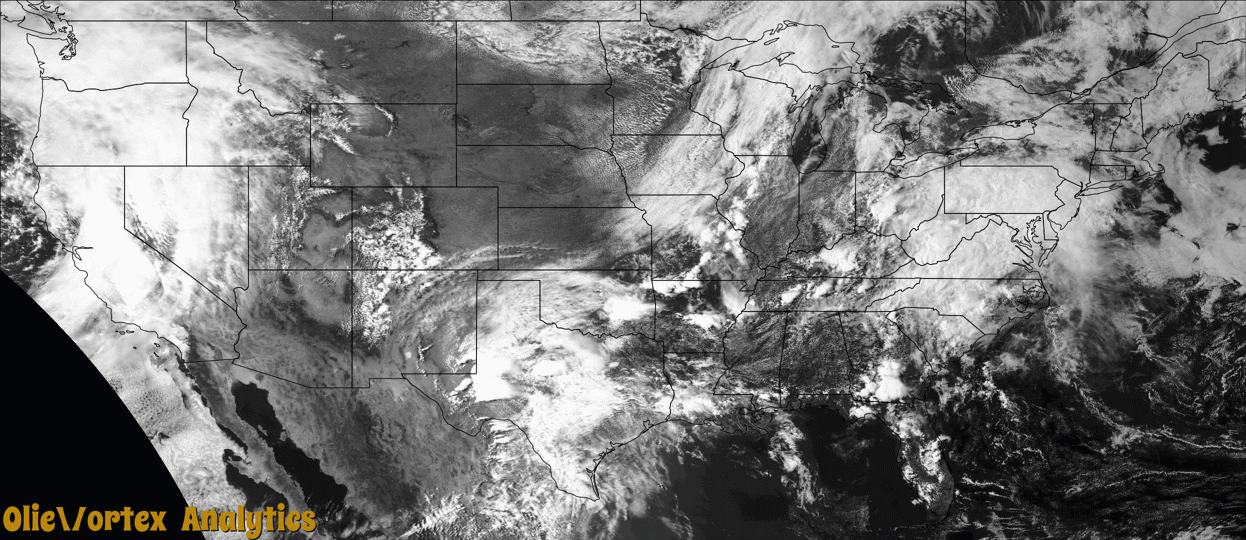
Tornado Reports
Sort by Time Sort by Rating Sort by State Sort by County| Time | Rating | Radar | State | County | Location | Narrative |
|---|---|---|---|---|---|---|
| 20:56Z | EF2 | KMAF | TX | Pecos | Belding | Results from this survey indicated that a tornado began just east of US Highway 35 south of Fort Stockton in rural central Pecos County. This tornado was documented by numerous observers, quickly developing into a photogenic stovepipe before becoming increasingly wrapped in rain. The tornado slowly moved southeast, before completely wrapping in rain and likely dissipating. This tornado occurred over mainly open terrain only causing damage to vegetation and a few wooden electrical power poles in the area. This tornado was rated as a mid-range EF-2 with maximum wind speeds of 125 MPH given the degree of damage to these wooden power poles which were snapped cleanly near the base. Property damage cost amount is an estimation. |
| 21:18Z | EFU | KMAF | TX | Pecos | Ft Stockton | This tornado was seen roping out about 20 minutes after the previous tornado was believed to have dissipated. This tornado is to be a separate tornado spotted in its dissipating stage. This tornado was not able to be surveyed due to the rural and rugged nature of the area west of US Highway 285. The approximate track is estimated by observer reports and radar data. No damage was reported. |
| 21:40Z | EFU | KMAF | TX | Pecos | Ft Stockton | A few observers reported a brief rope tornado developing as the second tornado dissipated. This tornado likely traveled for several minutes to the southeast before the condensation funnel was lost. Rapidly rotating rain curtains were noted afterward and the tornado was likely still ongoing. This tornado was later photographed by numerous observers as a stovepipe briefly visible through the rain. This tornado slowly traveled southeast before observers lost visual of the tornado in the rain. This tornado occurred over rugged and inaccessible terrain west of US Highway 285 and was unable to be surveyed. The track of the tornado is estimated based on observer reports in conjunction with radar data. No damage was reported. |
| 22:04Z | EFU | KMAF | TX | Pecos | Ft Stockton | An observer reported a new tornado in its dissipating stage. This tornado appeared to the observer as a brief rope tornado visible through the rain. The tornado occurred over rugged and inaccessible terrain west of US Highway 285 and was not able to be surveyed. This tornado track is estimated based on observer reports and radar data. This tornado may have been the end of the previous tornado as a strong couplet was maintained during this timeframe but was reported as a separate tornado by observers. No damage was reported. |
| 22:29Z | EFU | KMAF | TX | Pecos | Longfellow | An observer shared a video of a tornado briefly visible through heavy rain just west of US Highway 285. Observers lost a visual of the tornado a short time afterward. A strong couplet was noted on radar for several minutes after this video as the tornado likely slowly moved southeast, dissipating just west of the highway. A survey could not be conducted as the area west of US Highway 285 is inaccessible and no indicators showed the tornado crossing the highway. The track of this tornado is an estimation based on observer reports and radar data. No damage was reported. |
| 23:38Z | EFU | KIWX | OH | Mercer | Chattanooga | A weak landspout tornado was observed moving north in a field east of Burrville Road. The tornado caused no known damage. |
| 02:10Z | EF2 | KSJT | TX | Crockett | Ozona | The tornado damaged several structures on Acton Ranch about|26 miles south-southwest of Ozona, Texas. The tornado uplifted|and destroyed the roof structure of a barn with concrete walls. |The tornado also lifted a heavy metal bulk feeder at least 5 |feet in the air and moved it at least 150 feet from its original |location. The tornado also snapped the trunk of a 150 year old |cottonwood tree. The estimated peak wind speed of the |tornado was 115 mph. |
Storm reports are derived from "The Storm Events Database" (National Centers for Environmental Information) and/or "Past Storm Reports" (Storm Prediction Center).