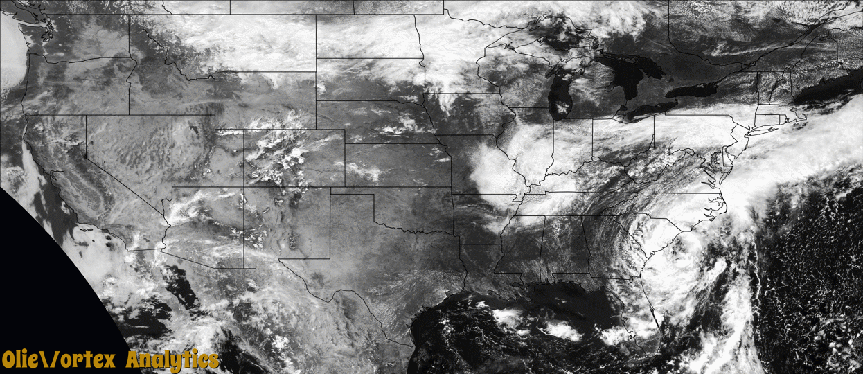
Tornado Reports
Sort by Time Sort by Rating Sort by State Sort by County| Time | Rating | Radar | State | County | Location | Narrative |
|---|---|---|---|---|---|---|
| 18:09Z | EF0 | KLTX | NC | Pender | Penderlea | A weak EF-0 tornado touched down in far northern Pender County before crossing into Sampson County along Willard Road. Multiple tree limbs and skinny hardwood trunks were found snapped as it crossed into a field where corn stalks were laid out in a wavy convergent path. |
| 18:10Z | EF2 | KLTX | NC | Sampson | Newtons Xrds | A weak EF-0 tornado touched down in far northern Pender county before crossing into Sampson County along Willard Road. Multiple tree limbs and skinny hardwood trucks were found snapped as it crossed into a field where corn stalks were laid out in a wavy |convergent path. The tornado continued on the ground northwest to US-421 achieving EF-1 strength, causing minor roof damage to a one-story residence, snapping a softwood tree in addition to several small 1-3 inch branches. After traversing a vast canopy of thick tree coverage and little road access, it reemerged and crossed over Wildcat Road and Bland School Road where it strengthened into a low-end EF-2 and caused significant damage to multiple well constructed residences. The first was on the |western flank of the circulation and ripped off a portions of the tin roof and scattered personal belongings into the front yard in addition to snapping thick 1-2 foot branches from a large hardwood tree. The second house suffered multiple windows being blown in and likely was the initiating factor in blowing of 50% of a well attached roof and displacing it in the corn field behind the residence. The tornado continued for roughly another 0.5 miles through an open field and lifted before reaching Belvin Maynard |Road. |
| 18:43Z | EF0 | KMHX | NC | Pender | Shelter Neck | A weak tornado associated with Tropical Storm Debby's rain bands snapped a tree at a property off of Old Maple Hill Road North and downed numerous large limbs in a concentrated path westward through the intersection of NC-50 with Old Maple Hill Road North. From eyewitness accounts, the tornado continued across a large|farm field and lifted soon after crossing NC-53. |
| 06:08Z | EF2 | KRAX | NC | Greene | Snow Hill | A tornado touched down near the intersection of Highway 903 and|Hull Road in Snow Hill. At this location, minor damage to trees|was noted, as well as significant damage to a wooden billboard|sign. The tornado then moved northwest, nearly parallel to Highway|58. Just north of Highway 13 and Highway 58, damage to trees and|structures was noted. Most notable in this area was damage to a|house and several nearby barns, carports, and outbuildings. The|damage was rated EF-1 in this area. The tornado continued|northwest along Highway 58, damaging trees along its path. Just|south of Highway 58 and Fort Run Road, a double wide mobile home|was destroyed, multiple wooden power poles were snapped, a barn|was destroyed, and a medium size pickup truck was moved, or|rolled, 50 to 75 feet. Damage in this area is consistent with at|least high end EF-2 wind speeds. Additional assessment may be|needed in this area to determine if the wind speed was higher.|Debris from the mobile was blown at least 100 yards downwind into|a field to the north. The tornado then crossed Fort Run Road, with|additional damage noted at Fort Run Road and Corbett Town Road. In|this area, numerous trees were damaged, with multiple trees|snapped at the base. There is clear evidence of the tornado path|through a row of trees in this area. Minor damage occurred to a|home and outbuildings in this area, consistent with EF-1 wind|speeds. The tornado continued northwest, crossing Griffin Road,|where significant damage to farm buildings, and a detached garage,|were noted. Numerous trees were snapped at the base in this area.|The damage to the buildings is consistent with EF-2 wind speeds.|The tornado continued northwest, crossing Apple Tree Road, where|significant damage to farm buildings was noted, consistent with|EF-2 wind speeds. Damage to farm outbuildings and a house was|noted in this area as well. Scattered tree damage was noted from|Apple Tree Road northwest to the Greene/Wayne County line. |
| 06:45Z | EF3 | KRAX | NC | Wilson | Black Creek | A tornado touched down near Hwy 301 about 2 WNW Black Creek then proceeded NW for approximately 6.5 miles before lifting 4 WNW Lucama. Numerous trees were snapped and several homes were severely damaged along Scott Church Rd. One home has considerable roof damage with roofing covering removed. The tornado continued |NW and did severe damage to Springfield Middle School where several sections of the roof were completely removed and several exterior and load bearing walls were blown out. At this location, wind was estimated to be 140 mph, which puts this tornado at the |EF-3 level on the Enhanced Fujita Scale. The tornado continued moving to the northwest, and along Lloyd Road a two story home completely collapsed after all four walls were blown over. It was here that one fatality occurred. The winds at this location were estimated to be 140 mph. The tornado lifted shortly after crossing Governor Hunt Rd, where a barn was destroyed and numerous trees were snapped and uprooted. |
Storm reports are derived from "The Storm Events Database" (National Centers for Environmental Information) and/or "Past Storm Reports" (Storm Prediction Center).